My go-to hike when I simply want to go out for the weekend and relax, Hinodeyama has a good range of options for anyone who wants to explore. It’s cheap, it’s easy to reach (no buses needed), and highly flexible to how long you want a hike to be. It doesn’t have the gorgeous views, but it’s a nice escape from the metropolis. Budget: JPY1,640 (~USD15) from Tokyo- JPY820. Train, Shinjuku Station to Musashi-Itsukaichi Station.
- JPY820. Hinatawada Station to Shinjuku Station.
Hike Date / Difficulty (Elevation: 902m/2959ft)- Winter 2018, Summer 2019, Spring 2020.
- Difficulty: A decent 2 out of 5. Difficulty can be adjusted based on the trail you wish to take.
- Route below is around 17.3km, with an elevation elevation change of ▲1589m/ ▽1562m
- Map Link
When to GoAnytime! I’ve been going throughout the year. Of course, prepare your jacket if you end up going in winter.Special Notes- Weather check: Japanese
- So. Many. Trails. You can explore on your own by clicking the map in this link, but here are some options you can try. Note: these are one way distances and m=meters gain(+) and loss (-)
- Easy. 2.9km, +338m/-272m, ~1hour. Take a cable car up Mt. Mitake (御岳山) and that will be your starting point. If you want to skip the cable car, it’s an additional 80 min walk up (~2.9km with +636m/-206m).
- Moderate. 10.2km, +1235m/-506m, ~4hours. Start at Musashi-Itsuikaichi Station (武蔵五日市駅).
- Difficult. 13.9km, +2069m/-1486m. ~6hours. Start at Okutama Station.
- No special equipment needed even during winter.
Itinerary
For this, I’m referencing the “moderate” level above, where I started at Musashi-Itsukaichi Station, and end at Hinatawada Station (日向和田駅).
- 04:54am. Depart at Shinjuku Station, going to Musashi-Itsukaichi Station.
- 06:14am. Arrival at Musashi-Itsukaichi Station, take the South Exit. A major highway will be there, turn right. You’ll be following this road for 15 minutes. Here’s a google maps pin to get you to the right direction, and once you’ve reached the place in this pin you should have a school compound to your right. Keep walking straight, and you should see signs pointing you to Mt. Hinode (日ノ出山)
- ~11:00am. Arrival at the summit. The summit has some nice seats and one cottage that you can stay at. Near the summit are some picnic table and seats where you can have your lunch.
- ~12:00pm. Start trek down.
- 02:30pm. Arrival at Hinatawada Station (日向和田駅), take train to Shinjuku Station. There are about two trains per hour, so check your time and run if need be. 😉
- 04:00pm. Arrival at Shinjuku Station.
 |
| The early signs do not have English on it, so look for Hinodeyama (日の出山) or Mt. Konpira (金比羅山) which is on the way. |
 |
There's a little viewing deck right behind the marker below.
|
 |
Here you can take a left or a right. The left one is a less used route, which is very bushy and does have the risk of more wildlife (insects, snakes) reclaiming the trail if people aren't using it.
|
 |
| The first portion of the trail follows a rough road. |
 |
If you go around spring, a portion of the trail is covered in flower petals. Seriously.
|
 |
Most of the hike is a gentle slope.
|
 |
Another nice viewing spot.
|
 |
This trail sees plenty of trail runners and mountain bikers.
|
 |
A bit of a gentle slope up.
|
 |
Beautiful trail!
|
 |
| One of my favorites - root trails! |
 |
| It was a gentle slope for most of the hike, but nonstop stairs up for the next 300meters or so. |
 |
Here's the summit! They have a nice cottage up there to enjoy the view.
|
 |
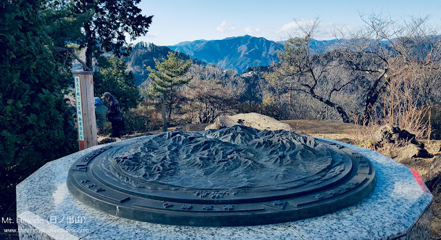
And here's the marker!
|


Comments
Post a Comment
Comments are like mail in my postbox. Such a nice surprise. ^__^